How to start hiking in Northwest Arkansas.
32 trailheads in Bella VistaView detailsHide

Allen’s Food Market
large, paved · full restrooms inside Allen's · Bella Vista

Artist Retreat Center (ARC) Trailhead
medium, grass · no restroom facilities · Bella Vista

Bear Hollow Trailhead
medium, paved · portable toilet · Bella Vista

Bella Vista AoG
large, paved · no restroom facilities at trailhead, but full restrooms at Casey's .3 miles away · Bella Vista
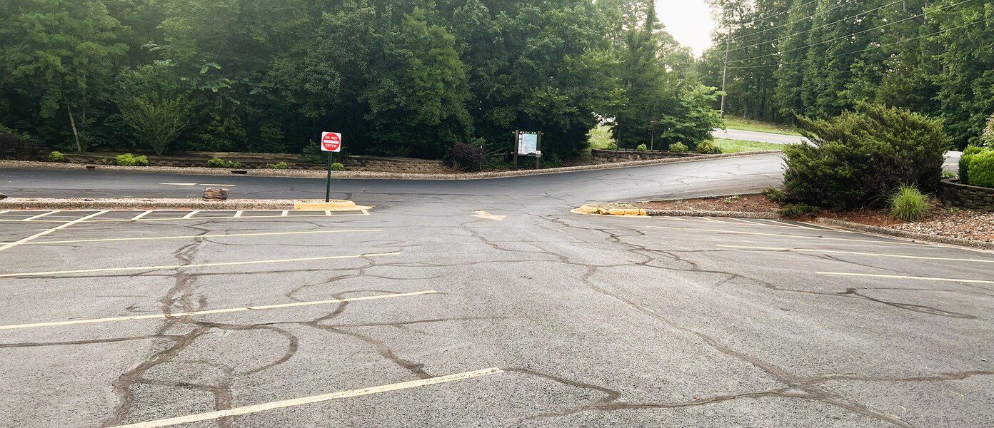
Bella Vista Community Church
large, paved · no restroom facilities · Bella Vista

Bella Vista Museum
medium, paved · full restrooms available inside the museum when it's open. · Bella Vista

Bella Vista Police Department
large, paved · full bathrooms inside the building when open · Bella Vista

Blowing Springs Trailhead
large, paved · portable toilet · Bella Vista

Bluebird Trailhead
small, paved · portable toilet available · Bella Vista

Branchwood
large, paved · restroom facilities when the recreation center is open · Bella Vista

Buckingham Trailhead
small, paved · portable toilet · Bella Vista

Chelsea & Arthur Trailhead
small, gravel · no restroom facilities · Bella Vista

Down Under Water Tower Trailhead
small gravel road · no restroom facilities · Bella Vista

Gear Garden
large, paved · full restrooms · Bella Vista

Kingsdale Trailhead
large, paved · full restrooms, but may be locked after hours · Bella Vista

Kingswood Trailhead
large, paved · full restrooms in the building/restaurant, but accessible only during business hours · Bella Vista

Lake Ann Trailhead
medium, paved · portable toilet · Bella Vista

Lake Avalon Trailhead
large, paved · full restrooms, but may be locked after hours; portable toilet always available · Bella Vista

London Drive Water Tower Trailhead
medium, gravel · no restroom facilities · Bella Vista

Mace Lane
small, paved cul-de-sac · no restroom facilities · Bella Vista

Metfield Skills Park
large, paved · full restrooms · Bella Vista

Pinion Creek Falls Trailhead
small, gravel pull-off · no restroom facilities; a portable toilet is available on top of the dam at the far end, but parking is restricted on the dam so you need to walk there. · Bella Vista

Play Thru Trailhead
Medium-size gravel · No restroom facilities · Bella Vista

Pontoon Park Trailhead
large, gravel · portable toilet · Bella Vista

Power Station
small, gravel · no restroom facilities · Bella Vista

Scotsdale Trailhead
large, paved · no restroom facilities · Bella Vista

Snowbird Trailhead
small, gravel · no restroom facilities · Bella Vista

Tanyard Creek
large, paved · full restrooms, but may be locked after hours · Bella Vista

Tower Trailhead
small, gravel · no restroom facilities · Bella Vista

Tweety Bird Trailhead
medium, gravel · portable toilet · Bella Vista

Veterans Wall of Honor
large, paved · full restrooms · Bella Vista

Wonderland Trailhead
medium, gravel · no restroom facilities · Bella Vista
Routes in Bella Vista
Too many options? Filter these by distance & difficulty →

Bluebird
.58 mi · 25 ft gain · 43 ft/mi · Loop · Bella Vista

Bella Vista Museum to Lake Rayburn Waterfall
0.6 mi · 50 ft gain · 83 ft/mi · Loop · Bella Vista
Depending on the amount of recent rain, the waterfall may be too deep to safely cross without getting your shoes very wet.
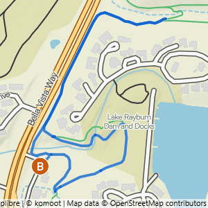
Bella Vista Museum to It'll Bluff Out Shortcut & Lake Rayburn Waterfall
1.17 mi · 100 ft gain · 85 ft/mi · Lollipop · Bella Vista

Veterans to Flash Flood & All American
1.47 mi · 25 ft gain · 17 ft/mi · Loop · Bella Vista

Branchwood Trail
1.52 mi · 125 ft gain · 82 ft/mi · Loop · Bella Vista
While this is a very nice paved trail, it is also very hilly. Walking this route clockwise is generally easier elevation-wise than walking counter-clockwise, as the inclines are more gradual.

Snowbird
1.53 mi · 75 ft gain · 49 ft/mi · Loop · Bella Vista

Pinion Creek Falls to Trafalgar on Back 40
1.65 mi · 50 ft gain · 30 ft/mi · Out & Back · Bella Vista
Pinion Creek Falls is right next to the trailhead.

Pinion Creek Falls to Trafalgar
1.69 mi · 100 ft gain · 59 ft/mi · Out & Back · Bella Vista
Pinion Creek Falls is right next to the trailhead.

Tweety Bird
1.74 mi · 75 ft gain · 43 ft/mi · Loop · Bella Vista

Kingswood to Riordon Tunnel
1.77 mi · 75 ft gain · 42 ft/mi · Out & Back · Bella Vista

Bluebird to Berksdale South Double Lollipop
1.84 mi · 25 ft gain · 14 ft/mi · Lollipop · Bella Vista

Bluebird to Tavistock Loop
1.85 mi · 200 ft gain · 108 ft/mi · Lollipop · Bella Vista

Pinion Creek Falls to Lancashire
1.94 mi · 175 ft gain · 90 ft/mi · Out & Back · Bella Vista
Pinion Creek Falls is right next to the trailhead.

Wonderland to Rabbit Hole & Sally Loop
1.98 mi · 200 ft gain · 101 ft/mi · Loop · Bella Vista

Bella Vista Museum to It'll Bluff Out & Lake Rayburn Waterfall
2.01 mi · 150 ft gain · 75 ft/mi · Lollipop · Bella Vista

Bear Hollow to the Crack Shack
2.06 mi · 75 ft gain · 36 ft/mi · Out & Back · Bella Vista

Blowing Springs to Blowing Springs North & Bomb Diggity
2.11 mi · 150 ft gain · 71 ft/mi · Loop · Bella Vista
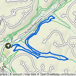
Blowing Springs to Low Ride
2.12 mi · 175 ft gain · 83 ft/mi · Loop · Bella Vista

Chelsea & Arthur to Pontoon Park
2.12 mi · 300 ft gain · 142 ft/mi · Out & Back · Bella Vista

Blowing Springs to West Euston
2.14 mi · 100 ft gain · 47 ft/mi · Out & Back · Bella Vista

Veterans to All American, Flash Flood, Smugglers & Sally
2.17 mi · 50 ft gain · 23 ft/mi · Loop · Bella Vista
Sally specifically has a lot of rocky obstacles.

Gear Garden to Low Ride
2.19 mi · 150 ft gain · 68 ft/mi · Loop · Bella Vista

Scotsdale to the Bridge
2.19 mi · 125 ft gain · 57 ft/mi · Out & Back · Bella Vista

Allen's to Berksdale South
2.2 mi · 25 ft gain · 11 ft/mi · Lollipop · Bella Vista

Tanyard Creek Nature Trail
2.2 mi · 175 ft gain · 80 ft/mi · Loop · Bella Vista

Pontoon Park to Highland Rd.
2.21 mi · 175 ft gain · 79 ft/mi · Out & Back · Bella Vista

Power Station to Back 40 Taylor
2.21 mi · 150 ft gain · 68 ft/mi · Out & Back · Bella Vista

Lake Ann to Pinyon & Brittany Dam
2.23 mi · 150 ft gain · 67 ft/mi · Out & Back · Bella Vista

Metfield to Trafalgar on Rago
2.26 mi · 175 ft gain · 77 ft/mi · Out & Back · Bella Vista

Buckingham to Summit School
2.27 mi · 250 ft gain · 110 ft/mi · Lollipop · Bella Vista

London Drive Water Tower to Landline
2.28 mi · 250 ft gain · 110 ft/mi · Out & Back · Bella Vista

Mace Lane to (Almost) Play Thru
2.29 mi · 200 ft gain · 87 ft/mi · Out & Back · Bella Vista

Kingsdale Loop North
2.3 mi · 175 ft gain · 76 ft/mi · Loop · Bella Vista

Down Under Water Tower to Tweety Tunnel
2.3 mi · 150 ft gain · 65 ft/mi · Out & Back · Bella Vista

Allen's to Berksdale South & Bluebird
2.32 mi · 25 ft gain · 11 ft/mi · Lollipop · Bella Vista

Kingswood to Danger Will Robinson
2.35 mi · 125 ft gain · 53 ft/mi · Lollipop · Bella Vista

Bluebird to Berksdale South
2.35 mi · 25 ft gain · 11 ft/mi · Lollipop · Bella Vista

Bluebird to Tavistock Loop & Snacks
2.37 mi · 200 ft gain · 84 ft/mi · Lollipop · Bella Vista

Play Thru to Lake Avalon Vista
2.4 mi · 350 ft gain · 146 ft/mi · Out & Back · Bella Vista

Bella Vista AoG to Sherlock
2.42 mi · 200 ft gain · 83 ft/mi · Out & Back · Bella Vista

Kingswood to Sugar Bridge
2.43 mi · 125 ft gain · 51 ft/mi · Out & Back · Bella Vista

Snowbird Double-Ear Loop
2.45 mi · 100 ft gain · 41 ft/mi · Loop · Bella Vista

Tanyard Creek & Tunnel Vision
2.5 mi · 175 ft gain · 70 ft/mi · Loop · Bella Vista

Bluebird to Sugar Vision & Snacks
2.56 mi · 125 ft gain · 49 ft/mi · Out & Back · Bella Vista

Veterans on the Greenway
2.56 mi · 25 ft gain · 10 ft/mi · Out & Back · Bella Vista

Tower Loop
2.58 mi · 225 ft gain · 87 ft/mi · Loop · Bella Vista
Some of this loop requires walking on the grass next to Bethnal Road, not on a defined trail. It does not require you to be immediately next to the road, but you may be walking through taller grass depending on the season, and perhaps needing to cross the road at times to get to better terrain.

Wonderland to Rabbit Hole & Mighty Pine Loop
2.59 mi · 200 ft gain · 77 ft/mi · Loop · Bella Vista
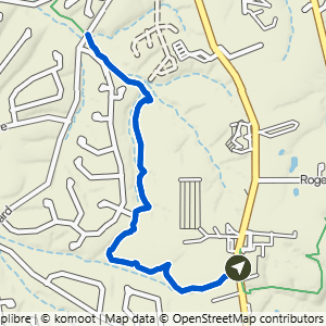
Bella Vista Police Department to Highlands
2.63 mi · 150 ft gain · 57 ft/mi · Out & Back · Bella Vista

Lake Avalon to Lago Vista West
2.64 mi · 150 ft gain · 57 ft/mi · Out & Back · Bella Vista

ARC to Sick-A-More & Down Under South
2.64 mi · 200 ft gain · 76 ft/mi · Lollipop · Bella Vista

Blowing Springs to Low Ride & Blowing Springs North
2.69 mi · 225 ft gain · 84 ft/mi · Loop · Bella Vista

Wonderland to Mighty Pine Loop
2.71 mi · 200 ft gain · 74 ft/mi · Loop · Bella Vista
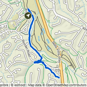
Kingswood to Sugar Vision & Snacks
2.75 mi · 125 ft gain · 45 ft/mi · Out & Back · Bella Vista

Bella Vista Museum to It'll Bluff Out South & Dalton Dr.
2.79 mi · 100 ft gain · 36 ft/mi · Out & Back · Bella Vista

Veterans to Mighty Pine
2.79 mi · 200 ft gain · 72 ft/mi · Loop · Bella Vista

Veterans to Rabbit Hole & Mighty Pine
2.84 mi · 225 ft gain · 79 ft/mi · Loop · Bella Vista


Veterans to Through the Looking Glass
2.9 mi · 225 ft gain · 78 ft/mi · Loop · Bella Vista

Metfield to Merritt Dr.
2.91 mi · 125 ft gain · 43 ft/mi · Out & Back · Bella Vista
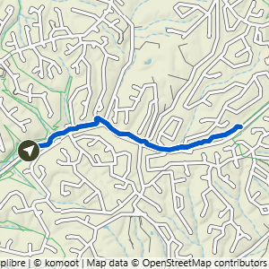
Gear Garden to Back 40
2.92 mi · 125 ft gain · 43 ft/mi · Out & Back · Bella Vista
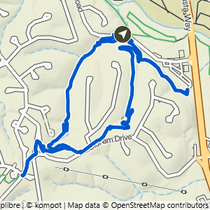
Bluebird to Tavistock Loop, Snacks & Chelsea
3 mi · 275 ft gain · 92 ft/mi · Lollipop · Bella Vista

Blowing Springs to Mighty Pine
3.06 mi · 300 ft gain · 98 ft/mi · Loop · Bella Vista

Gear Garden to Greenway 5K
3.12 mi · 125 ft gain · 40 ft/mi · Out & Back · Bella Vista

Bella Vista Community Church to Pinion Creek Falls
3.13 mi · 225 ft gain · 72 ft/mi · Out & Back · Bella Vista

Play Thru Loop
3.14 mi · 275 ft gain · 88 ft/mi · Loop · Bella Vista

Gear Garden to Bomb Diggity & Blowing Springs South
3.17 mi · 200 ft gain · 63 ft/mi · Loop · Bella Vista

Pinion Creek Falls to Bella Vista Community Church
3.18 mi · 225 ft gain · 71 ft/mi · Out & Back · Bella Vista
Pinion Creek Falls is right next to the trailhead.

Pinion Creek Falls to It'll Bluff Out Lollipop
3.19 mi · 200 ft gain · 63 ft/mi · Lollipop · Bella Vista
Pinion Creek Falls is right next to the trailhead.

Chelsea & Arthur to Tunnel Vision North
3.21 mi · 400 ft gain · 125 ft/mi · Out & Back · Bella Vista

Chelsea & Arthur to Uphill Both Ways
3.21 mi · 350 ft gain · 109 ft/mi · Out & Back · Bella Vista

Bella Vista Museum to Pinion Creek Falls
3.22 mi · 175 ft gain · 54 ft/mi · Lollipop · Bella Vista

Metfield to Greenway & Rago Lollipop
3.22 mi · 150 ft gain · 47 ft/mi · Lollipop · Bella Vista

Gear Garden to Blowing Springs North & Bomb Diggity
3.25 mi · 275 ft gain · 85 ft/mi · Loop · Bella Vista

Lake Ann to Summit School
3.25 mi · 325 ft gain · 100 ft/mi · Out & Back · Bella Vista

Blowing Springs to Mighty Pine
3.27 mi · 325 ft gain · 99 ft/mi · Loop · Bella Vista

Veterans to Wonderland Parallels
3.27 mi · 75 ft gain · 23 ft/mi · Lollipop · Bella Vista

Tower to Back 40
3.28 mi · 250 ft gain · 76 ft/mi · Out & Back · Bella Vista

Gear Garden to Greenway East
3.31 mi · 150 ft gain · 45 ft/mi · Out & Back · Bella Vista

Blowing Springs South & Back 40
3.34 mi · 200 ft gain · 60 ft/mi · Loop · Bella Vista

Blowing Springs to Bomb Diggity, Back 40 & Low Ride
3.35 mi · 250 ft gain · 75 ft/mi · Loop · Bella Vista

Bluebird to Sugar Vision & Tavistock Canyon
3.35 mi · 275 ft gain · 82 ft/mi · Lollipop · Bella Vista

Lake Ann to Flo Ride
3.35 mi · 375 ft gain · 112 ft/mi · Out & Back · Bella Vista

Blowing Springs to Sally, Smuggler's & All-American
3.36 mi · 250 ft gain · 74 ft/mi · Lollipop · Bella Vista
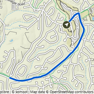
Metfield to Watson Dr.
3.36 mi · 150 ft gain · 45 ft/mi · Out & Back · Bella Vista

Gear Garden to Back 40, Bomb Diggity & Low Ride
3.38 mi · 250 ft gain · 74 ft/mi · Loop · Bella Vista
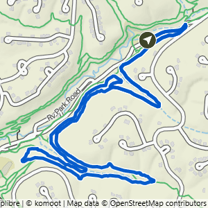
Gear Garden to Blowing Springs South & Low Ride
3.38 mi · 250 ft gain · 74 ft/mi · Lollipop · Bella Vista

Scotsdale to Technical Difficulty
3.38 mi · 175 ft gain · 52 ft/mi · Lollipop · Bella Vista

Gear Garden to Back 40 & Greenway
3.39 mi · 200 ft gain · 59 ft/mi · Loop · Bella Vista
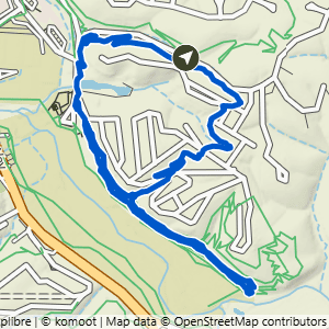
Wonderland to Sally, Smugglers, All American & Rabbit Hole
3.4 mi · 250 ft gain · 74 ft/mi · Loop · Bella Vista
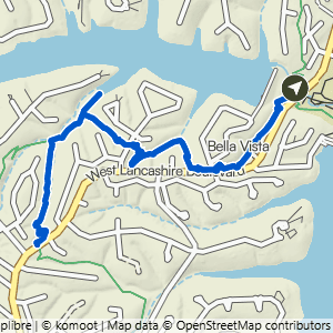
Play Thru to Uphill Both Ways
3.42 mi · 375 ft gain · 110 ft/mi · Out & Back · Bella Vista

Gear Garden to (Most of) Blowing Springs North & South
3.42 mi · 275 ft gain · 80 ft/mi · Loop · Bella Vista

Chelsea & Arthur to Tunnel Vision South
3.44 mi · 325 ft gain · 94 ft/mi · Out & Back · Bella Vista

Lake Avalon to Uphill Both Ways
3.44 mi · 375 ft gain · 109 ft/mi · Out & Back · Bella Vista

Tweety Bird to Tunnel Vision West
3.44 mi · 300 ft gain · 87 ft/mi · Out & Back · Bella Vista

Tweety Bird to Tavistock
3.46 mi · 400 ft gain · 116 ft/mi · Lollipop · Bella Vista

Kingsdale to Danger Will Robinson
3.48 mi · 250 ft gain · 72 ft/mi · Loop · Bella Vista

Down Under Water Tower to London Rd Water Tower
3.5 mi · 275 ft gain · 79 ft/mi · Out & Back · Bella Vista

Wonderland to All American, Smugglers, Woz Up & Rabbit Hole
3.51 mi · 350 ft gain · 100 ft/mi · Loop · Bella Vista

Bear Hollow to Back 40 West
3.51 mi · 300 ft gain · 85 ft/mi · Out & Back · Bella Vista

Pontoon Park to Bella Vista Police Station
3.51 mi · 300 ft gain · 85 ft/mi · Out & Back · Bella Vista

Wonderland to Mighty Pine, Low Ride & Cooper
3.53 mi · 300 ft gain · 85 ft/mi · Loop · Bella Vista

Kingswood to Sugar Vision & Tavistock Loop
3.54 mi · 275 ft gain · 78 ft/mi · Lollipop · Bella Vista

Bella Vista Police Department to Pontoon Park
3.58 mi · 300 ft gain · 84 ft/mi · Out & Back · Bella Vista

Chelsea & Arthur North to Clive Lane
3.59 mi · 350 ft gain · 97 ft/mi · Out & Back · Bella Vista

Wonderland to Rabbit Hole, Looking Glass & Sally
3.63 mi · 375 ft gain · 103 ft/mi · Loop · Bella Vista

Tweety Bird & Landline
3.63 mi · 300 ft gain · 83 ft/mi · Lollipop · Bella Vista

Power Station to Sister Ledges
3.65 mi · 200 ft gain · 55 ft/mi · Out & Back · Bella Vista

Tweety Bird to Down Under
3.68 mi · 325 ft gain · 88 ft/mi · Out & Back · Bella Vista

Play Thru to Mace Lane
3.7 mi · 350 ft gain · 95 ft/mi · Out & Back · Bella Vista
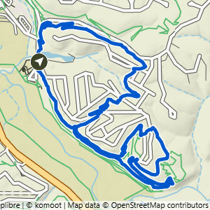
Veterans to Sally, Looking Glass & Rabbit Hole Loop
3.7 mi · 375 ft gain · 101 ft/mi · Loop · Bella Vista
Sally specifically has a lot of rocky obstacles.

Wonderland to Rabbit Hole, All American & Looking Glass
3.71 mi · 375 ft gain · 101 ft/mi · Loop · Bella Vista

Bella Vista Police Department to Glasgow
3.72 mi · 275 ft gain · 74 ft/mi · Out & Back · Bella Vista

London Drive Water Tower to Tavistock & Sugar Vision
3.72 mi · 325 ft gain · 87 ft/mi · Out & Back · Bella Vista

Scotsdale to Scalloway
3.72 mi · 350 ft gain · 94 ft/mi · Out & Back · Bella Vista

Tanyard Creek to Lago Vista East, Play Thru & Tunnel Vision
3.74 mi · 325 ft gain · 87 ft/mi · Loop · Bella Vista

Bear Hollow to Bear Hollow Cave & Crack Shack
3.76 mi · 200 ft gain · 53 ft/mi · Out & Back · Bella Vista
The trail down to Bear Hollow Cave is extremely steep.

Bella Vista Museum to Buckingham
3.77 mi · 300 ft gain · 80 ft/mi · Out & Back · Bella Vista

Kingsdale to Tavistock Loop
3.77 mi · 300 ft gain · 80 ft/mi · Lollipop · Bella Vista

Mace Lane to Tanyard Tunnel
3.81 mi · 350 ft gain · 92 ft/mi · Out & Back · Bella Vista

Gear Garden to Low Ride + Blowing Springs North
3.82 mi · 350 ft gain · 92 ft/mi · Loop · Bella Vista

ARC to Sick-A-More Green, Down Under & Vista Loop
3.82 mi · 275 ft gain · 72 ft/mi · Loop · Bella Vista

Bluebird to Sugar Vision, Tavistock Loop & Snacks
3.83 mi · 275 ft gain · 72 ft/mi · Lollipop · Bella Vista

London Drive Water Tower to Tavistock, Snacks & Sugar Vision
3.84 mi · 325 ft gain · 85 ft/mi · Lollipop · Bella Vista

ARC to Vista, Down Under & Sick-A-More Loop
3.85 mi · 275 ft gain · 71 ft/mi · Loop · Bella Vista
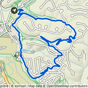
Blowing Springs to Rabbit Hole & Mighty Pine
3.88 mi · 375 ft gain · 97 ft/mi · Loop · Bella Vista

Blowing Springs to Low Ride & Mighty Pine
3.9 mi · 375 ft gain · 96 ft/mi · Loop · Bella Vista

Tanyard Creek to Tunnel Vision & Play Thru
3.92 mi · 325 ft gain · 83 ft/mi · Loop · Bella Vista

Bella Vista AoG to Scalloway
3.95 mi · 350 ft gain · 89 ft/mi · Out & Back · Bella Vista

Lake Ann to Summit School & B40
3.95 mi · 350 ft gain · 89 ft/mi · Out & Back · Bella Vista

Lake Avalon to Bamboozled
3.97 mi · 350 ft gain · 88 ft/mi · Out & Back · Bella Vista

Buckingham to Rago
3.98 mi · 375 ft gain · 94 ft/mi · Out & Back · Bella Vista

London Drive Water Tower to Down Under
4.01 mi · 350 ft gain · 87 ft/mi · Lollipop · Bella Vista

Gear Garden to Back 40, Blowing Springs North & Bomb Diggity
4.02 mi · 325 ft gain · 81 ft/mi · Loop · Bella Vista

ARC to Sick-A-More & Down Under West
4.05 mi · 400 ft gain · 99 ft/mi · Lollipop · Bella Vista
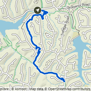
Lake Ann to Summit School & Rago
4.08 mi · 425 ft gain · 104 ft/mi · Out & Back · Bella Vista

Tanyard Creek to Lago Vista East
4.08 mi · 375 ft gain · 92 ft/mi · Out & Back · Bella Vista
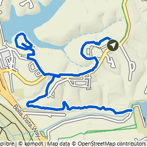
Bella Vista Community Church to Cooper Chapel & Pinion Creek Falls
4.1 mi · 275 ft gain · 67 ft/mi · Lollipop · Bella Vista

Tanyard Creek and Lago Vista East
4.1 mi · 350 ft gain · 85 ft/mi · Lollipop · Bella Vista

Down Under Water Tower to Tweety Loop
4.11 mi · 225 ft gain · 55 ft/mi · Lollipop · Bella Vista

Buckingham to Pinion Creek Falls
4.14 mi · 325 ft gain · 79 ft/mi · Out & Back · Bella Vista

Lake Avalon to Huntley
4.14 mi · 450 ft gain · 109 ft/mi · Out & Back · Bella Vista
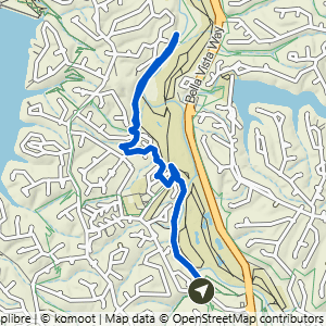
Bluebird to Sugar Vision & Danger Will Robinson
4.14 mi · 200 ft gain · 48 ft/mi · Lollipop · Bella Vista

Lake Ann to Brittany Dam & Pinyon Creek
4.16 mi · 275 ft gain · 66 ft/mi · Out & Back · Bella Vista

Bear Hollow to Back 40 East
4.21 mi · 225 ft gain · 53 ft/mi · Out & Back · Bella Vista

Lake Avalon to Lago Vista West & Highlands Rd.
4.22 mi · 275 ft gain · 65 ft/mi · Out & Back · Bella Vista
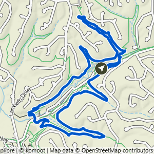
Gear Garden to Blowing Springs North & South
4.27 mi · 400 ft gain · 94 ft/mi · Loop · Bella Vista
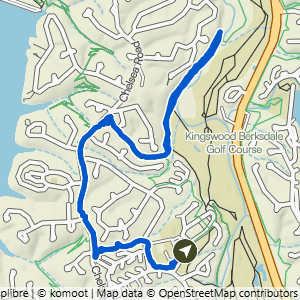
Kingsdale to Danger Will Robinson Lollipop
4.28 mi · 350 ft gain · 82 ft/mi · Lollipop · Bella Vista

Chelsea & Arthur to Highland Rd.
4.33 mi · 450 ft gain · 104 ft/mi · Out & Back · Bella Vista

Bella Vista AoG to Lake Avalon View
4.37 mi · 375 ft gain · 86 ft/mi · Out & Back · Bella Vista

Bear Hollow East & Crack Shack
4.4 mi · 225 ft gain · 51 ft/mi · Out & Back · Bella Vista

Lake Ann to Tip of the Spear
4.42 mi · 400 ft gain · 90 ft/mi · Lollipop · Bella Vista

ARC to Sick-A-More & Down Under Double Lollipop
4.42 mi · 375 ft gain · 85 ft/mi · Lollipop · Bella Vista

Kingsdale to Danger Will Robinson & Sugar Vision
4.44 mi · 300 ft gain · 68 ft/mi · Lollipop · Bella Vista

Scotsdale to Forest Hills
4.44 mi · 325 ft gain · 73 ft/mi · Out & Back · Bella Vista

Blowing Springs to It'll Bluff Out
4.48 mi · 400 ft gain · 89 ft/mi · Out & Back · Bella Vista

Blowing Springs to Low Ride, Cooper & Mighty Pine
4.48 mi · 400 ft gain · 89 ft/mi · Lollipop · Bella Vista

Gear Garden to Back 40, Blowing Springs North, It'll Bluff Out & Bomb Diggity
4.49 mi · 425 ft gain · 95 ft/mi · Lollipop · Bella Vista
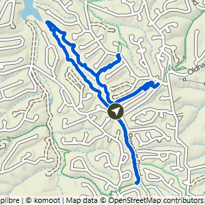
Tweety Bird, Landline & Tunnel Vision
4.52 mi · 350 ft gain · 77 ft/mi · Lollipop · Bella Vista

Scotsdale to Technical Difficulty+
4.56 mi · 250 ft gain · 55 ft/mi · Lollipop · Bella Vista

Down Under Water Tower to Down Under & Sick-A-More
4.57 mi · 450 ft gain · 98 ft/mi · Lollipop · Bella Vista
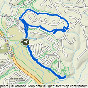
Veterans to Mighty Pine, Sally & Smugglers
4.58 mi · 275 ft gain · 60 ft/mi · Loop · Bella Vista
Sally specifically has a lot of rocky obstacles.

Lake Ann to Summit School & Rago+
4.6 mi · 450 ft gain · 98 ft/mi · Out & Back · Bella Vista

Bluebird to Tavistock, Water Tower, Snacks & Sugar Vision
4.61 mi · 400 ft gain · 87 ft/mi · Lollipop · Bella Vista
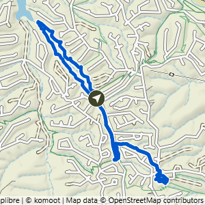
Tweety Bird to Down Under Double Lollipop
4.61 mi · 300 ft gain · 65 ft/mi · Lollipop · Bella Vista

Bella Vista AoG to Bella Vista Police Station
4.7 mi · 325 ft gain · 69 ft/mi · Out & Back · Bella Vista

Bella Vista AoG to Lancashire
4.71 mi · 425 ft gain · 90 ft/mi · Out & Back · Bella Vista


Mace Lane to Staggerwing
4.79 mi · 425 ft gain · 89 ft/mi · Out & Back · Bella Vista

Wonderland to Rabbit Hole, Looking Glass & Sally
4.83 mi · 500 ft gain · 104 ft/mi · Loop · Bella Vista

Bella Vista Community Church to Pinion Creek Falls & Lookout+
4.87 mi · 325 ft gain · 67 ft/mi · Out & Back · Bella Vista

Tanyard Creek to Play Thru & Tunnel Vision
4.88 mi · 425 ft gain · 87 ft/mi · Loop · Bella Vista

Lake Avalon to Huntley on Uphill Both Ways
4.9 mi · 550 ft gain · 112 ft/mi · Out & Back · Bella Vista
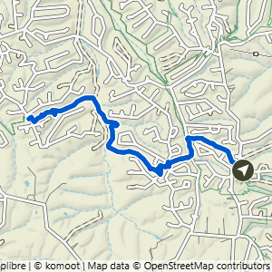
Down Under Water Tower to Hampton Rd.
4.91 mi · 500 ft gain · 102 ft/mi · Out & Back · Bella Vista
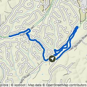
Snowbird to Back 40
4.93 mi · 300 ft gain · 61 ft/mi · Lollipop · Bella Vista

Allen's to It'll Bluff Out & Lake Rayburn Waterfall
4.96 mi · 200 ft gain · 40 ft/mi · Lollipop · Bella Vista
Depending on the amount of recent rain, the waterfall may be too deep to safely cross without getting your shoes very wet.

Bella Vista Community Church to Cooper Chapel & Lookout
4.96 mi · 350 ft gain · 71 ft/mi · Lollipop · Bella Vista

Wonderland to Mighty Pine, Low Ride & Bomb Diggity
4.98 mi · 400 ft gain · 80 ft/mi · Loop · Bella Vista

Buckingham to It'll Bluff Out
4.98 mi · 400 ft gain · 80 ft/mi · Lollipop · Bella Vista

Pontoon Park to Uphill Both Ways
4.98 mi · 425 ft gain · 85 ft/mi · Out & Back · Bella Vista

Gear Garden to Blowing Springs, Low Ride & Mighty Pine
4.99 mi · 375 ft gain · 75 ft/mi · Lollipop · Bella Vista

Power Station to Double Ledges Loop
5.08 mi · 325 ft gain · 64 ft/mi · Loop · Bella Vista

Buckingham to Trafalgar
5.12 mi · 475 ft gain · 93 ft/mi · Lollipop · Bella Vista

Wonderland to Mighty Blowing Biggity
5.15 mi · 650 ft gain · 126 ft/mi · Loop · Bella Vista

Bella Vista AoG to Lago Vista East, Uphilll & Lake Avalon Vista
5.16 mi · 450 ft gain · 87 ft/mi · Out & Back · Bella Vista
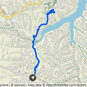
Chelsea & Arthur to Huntley Lane
5.18 mi · 500 ft gain · 97 ft/mi · Out & Back · Bella Vista

Wonderland to Bomb Diggity, Low Ride & Mighty Pine
5.23 mi · 400 ft gain · 76 ft/mi · Loop · Bella Vista

Tanyard Creek to Tunnel Vision & Cooper Road
5.29 mi · 450 ft gain · 85 ft/mi · Lollipop · Bella Vista

Veterans to Wonderland, Rabbit & Mighty Pine
5.36 mi · 450 ft gain · 84 ft/mi · Loop · Bella Vista
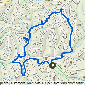
Power Station to Taylor Homestead & SBAT Loop
5.37 mi · 425 ft gain · 79 ft/mi · Loop · Bella Vista

Scotsdale to Sherlock
5.37 mi · 500 ft gain · 93 ft/mi · Out & Back · Bella Vista

Pinion Creek Falls to Back 40 & Tip of the Spear
5.38 mi · 425 ft gain · 79 ft/mi · Lollipop · Bella Vista
Pinion Creek Falls is right next to the trailhead.

Chelsea & Arthur to Prescott
5.39 mi · 500 ft gain · 93 ft/mi · Out & Back · Bella Vista

Down Under Water Tower to Down Under Loop
5.39 mi · 550 ft gain · 102 ft/mi · Loop · Bella Vista

Veterans to Low Ride, Mighty Pine & Wonderland
5.41 mi · 525 ft gain · 97 ft/mi · Loop · Bella Vista
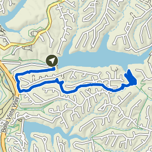
Pinion Creek Falls to Tip of the Spear
5.42 mi · 475 ft gain · 88 ft/mi · Lollipop · Bella Vista
Pinion Creek Falls is right next to the trailhead.
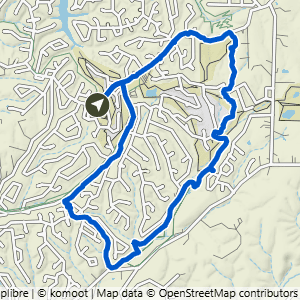
Metfield to Happy Hour Loop
5.46 mi · 300 ft gain · 55 ft/mi · Loop · Bella Vista

Bear Hollow Loop West
5.56 mi · 525 ft gain · 94 ft/mi · Loop · Bella Vista

Mace Lane to Long Shadow
5.59 mi · 500 ft gain · 89 ft/mi · Lollipop · Bella Vista
Long Shadow tends to get very overgrown in the spring and summer, so this route is best hiked in the fall and winter when the vegetation is minimal.

Power Station to Double Ledges Lollipop
5.75 mi · 350 ft gain · 61 ft/mi · Lollipop · Bella Vista

London Drive Water Tower Loop
5.78 mi · 575 ft gain · 99 ft/mi · Loop · Bella Vista

Play Thru to Tanyard Lollipop
5.8 mi · 550 ft gain · 95 ft/mi · Lollipop · Bella Vista
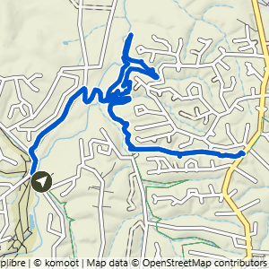
Scotsdale to Technical Difficulty & Tunnel Vision
5.8 mi · 400 ft gain · 69 ft/mi · Lollipop · Bella Vista

Snowbird to Happy Hour Loop
5.82 mi · 300 ft gain · 52 ft/mi · Lollipop · Bella Vista
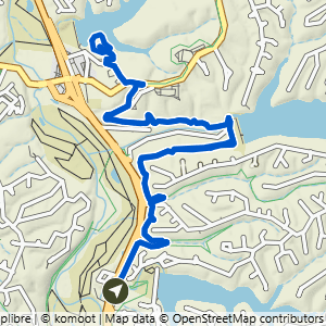
Bella Vista Museum to Cooper Chapel
5.99 mi · 425 ft gain · 71 ft/mi · Lollipop · Bella Vista

Mace Lane to Staggerwing Zone
6.01 mi · 525 ft gain · 87 ft/mi · Lollipop · Bella Vista

Metfield to Blowing Springs
6.02 mi · 275 ft gain · 46 ft/mi · Out & Back · Bella Vista

Mace Lane to Staggerwing Zone & Long Shadow
6.03 mi · 550 ft gain · 91 ft/mi · Lollipop · Bella Vista
Long Shadow tends to get very overgrown in the spring and summer, so this route is best hiked in the fall and winter when the vegetation is minimal.

Bella Vista Museum to It'll Bluff Out South
6.18 mi · 450 ft gain · 73 ft/mi · Out & Back · Bella Vista

Kingsdale Loop South
6.18 mi · 600 ft gain · 97 ft/mi · Loop · Bella Vista

Lake Ann SBAT & Taylor Lollipop
6.32 mi · 475 ft gain · 75 ft/mi · Lollipop · Bella Vista

Bella Vista AoG to Tanyard Tunnel
6.37 mi · 575 ft gain · 90 ft/mi · Out & Back · Bella Vista

Play Thru to Danger Will Robinson
6.38 mi · 525 ft gain · 82 ft/mi · Lollipop · Bella Vista

Metfield to Lambeth
6.42 mi · 300 ft gain · 47 ft/mi · Out & Back · Bella Vista
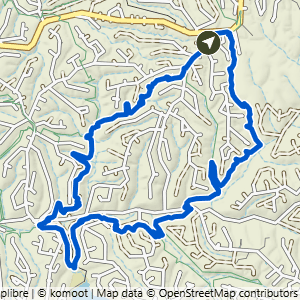
Tower South Loop
6.51 mi · 525 ft gain · 81 ft/mi · Loop · Bella Vista
Some of this loop requires walking on the grass next to Bethnal Road, not on a defined trail. It does not require you to be immediately next to the road, but you may be walking through taller grass depending on the season, and perhaps needing to cross the road at times to get to better terrain.

Snowbird Loop & Happy Hour Loop
6.52 mi · 350 ft gain · 54 ft/mi · Loop · Bella Vista

Bella Vista Museum to Tip of the Spear
6.56 mi · 575 ft gain · 88 ft/mi · Lollipop · Bella Vista

Bella Vista Community Church to the Cave
6.57 mi · 525 ft gain · 80 ft/mi · Out & Back · Bella Vista
The trail down to Bear Hollow Cave is extremely steep.

Down Under Water Tower to Down Under, Vista & Sick-A-More Loop
6.77 mi · 575 ft gain · 85 ft/mi · Loop · Bella Vista

Tanyard Creek to Danger Will Robinson
6.81 mi · 550 ft gain · 81 ft/mi · Lollipop · Bella Vista

Metfield to Rago Loop
6.83 mi · 525 ft gain · 77 ft/mi · Loop · Bella Vista

Bear Hollow Loop East
6.86 mi · 500 ft gain · 73 ft/mi · Loop · Bella Vista
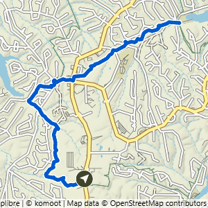
Bella Vista Police Department to Lake Avalon
6.87 mi · 425 ft gain · 62 ft/mi · Out & Back · Bella Vista

Buckingham to Cooper Chapel
6.89 mi · 550 ft gain · 80 ft/mi · Lollipop · Bella Vista

Lake Avalon to Tunnel Vision North
6.93 mi · 575 ft gain · 83 ft/mi · Out & Back · Bella Vista

Bella Vista Community Church to the Cave & Mildenhall
6.94 mi · 575 ft gain · 83 ft/mi · Out & Back · Bella Vista
The trail down to Bear Hollow Cave is extremely steep.

Blowing Springs to It'll Bluff Out at Kingsland
6.94 mi · 500 ft gain · 72 ft/mi · Out & Back · Bella Vista

Metfield to Happy Hour Loop & Snowbird
7 mi · 375 ft gain · 54 ft/mi · Loop · Bella Vista

Veterans to Mighty Biggity 40 Springs Loop
7.01 mi · 575 ft gain · 82 ft/mi · Loop · Bella Vista

Gear Garden Loop East
7.07 mi · 525 ft gain · 74 ft/mi · Loop · Bella Vista

Gear Garden to Blowing Springs & Back40 Loop
7.12 mi · 550 ft gain · 77 ft/mi · Loop · Bella Vista

Lake Ann Loop East
7.46 mi · 625 ft gain · 84 ft/mi · Loop · Bella Vista

Bear Hollow to Flo Ride & SBAT
7.61 mi · 675 ft gain · 89 ft/mi · Loop · Bella Vista

Tweety Bird to Tavistock, Snacks & Landline
7.62 mi · 700 ft gain · 92 ft/mi · Lollipop · Bella Vista
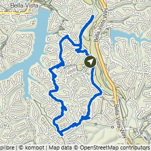
Kingsdale to Danger Will Robinson Loop
7.76 mi · 675 ft gain · 87 ft/mi · Loop · Bella Vista

Lake Ann to Summit, Rago, Mulligan, Sister Ledges & Pinyon
7.78 mi · 625 ft gain · 80 ft/mi · Loop · Bella Vista

ARC to Sick-A-More South, Tweety Tunnel, Down Under & Vista
7.92 mi · 650 ft gain · 82 ft/mi · Loop · Bella Vista
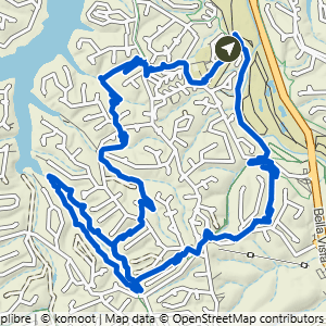
Kingsdale Loop to Tavistock & Tweety
7.97 mi · 650 ft gain · 82 ft/mi · Loop · Bella Vista

Play Thru Loop & Danger Will Robinson
8.22 mi · 700 ft gain · 85 ft/mi · Lollipop · Bella Vista

Bluebird to Sugar Vision, Danger Will Robinson & Tavistock Loop
8.23 mi · 625 ft gain · 76 ft/mi · Lollipop · Bella Vista

Lake Ann to Pinyon Creek & Double Ledges
8.7 mi · 550 ft gain · 63 ft/mi · Lollipop · Bella Vista

Bear Hollow East to Back 40 & SBAT
8.78 mi · 625 ft gain · 71 ft/mi · Loop · Bella Vista

Bella Vista Police Department to Pacifico Loop
8.79 mi · 725 ft gain · 82 ft/mi · Loop · Bella Vista
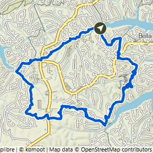
Lake Avalon to Pacifico Loop
8.79 mi · 700 ft gain · 80 ft/mi · Loop · Bella Vista

Pontoon Park Loop
8.83 mi · 725 ft gain · 82 ft/mi · Loop · Bella Vista

Metfield to Rago, Pinyon Creek & Ledges
8.91 mi · 650 ft gain · 73 ft/mi · Loop · Bella Vista

Buckingham Loop South
8.92 mi · 800 ft gain · 90 ft/mi · Loop · Bella Vista

Power Station Loop South
8.92 mi · 650 ft gain · 73 ft/mi · Loop · Bella Vista
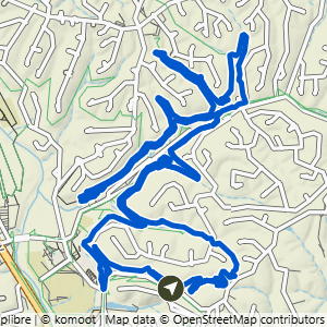
Wonderland to Mighty Blowing 40 Biggity
8.94 mi · 700 ft gain · 78 ft/mi · Loop · Bella Vista

ARC to Sick-A-More, Down Under & Tweety
9.08 mi · 750 ft gain · 83 ft/mi · Lollipop · Bella Vista

Veterans to Wonderland & Blowing Springs Loop
9.23 mi · 825 ft gain · 89 ft/mi · Loop · Bella Vista
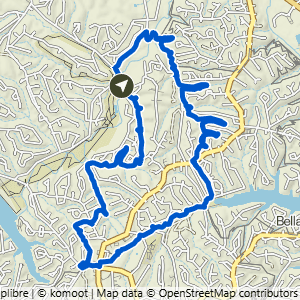
Scotsdale to Modelo Loop
9.4 mi · 750 ft gain · 80 ft/mi · Loop · Bella Vista

Lake Avalon to Modelo Loop
9.45 mi · 750 ft gain · 79 ft/mi · Loop · Bella Vista

Bear Hollow to Back 40, Skipton & Flo Ride
9.67 mi · 775 ft gain · 80 ft/mi · Loop · Bella Vista

Buckingham Loop with Lake Rayburn Waterfall
9.83 mi · 875 ft gain · 89 ft/mi · Loop · Bella Vista
Depending on the amount of recent rain, the waterfall may be too deep to safely cross without getting your shoes very wet.

Metfield Big Loop South
9.94 mi · 700 ft gain · 70 ft/mi · Loop · Bella Vista

Bella Vista Museum Loop East
10.2 mi · 900 ft gain · 88 ft/mi · Loop · Bella Vista

Bear Hollow Big Loop
10.6 mi · 850 ft gain · 80 ft/mi · Loop · Bella Vista

Lake Ann Butterfly Loop
10.6 mi · 900 ft gain · 85 ft/mi · Loop · Bella Vista

Gear Garden Loop North
10.7 mi · 800 ft gain · 75 ft/mi · Loop · Bella Vista
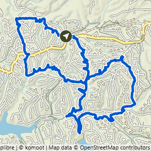
Bear Hollow Skip Town Figure 8
10.9 mi · 950 ft gain · 87 ft/mi · Loop · Bella Vista

Buckingham Loop South+
10.9 mi · 975 ft gain · 89 ft/mi · Loop · Bella Vista

Lake Avalon to Staggerwing Loop
10.9 mi · 1025 ft gain · 94 ft/mi · Loop · Bella Vista

Buckingham to Ledges Lollipop
11 mi · 850 ft gain · 77 ft/mi · Lollipop · Bella Vista

Lake Ann Loop West
11 mi · 975 ft gain · 89 ft/mi · Loop · Bella Vista

Buckingham Loop North
11.5 mi · 975 ft gain · 85 ft/mi · Loop · Bella Vista

Lake Ann Butterfly Lollipop
11.6 mi · 975 ft gain · 84 ft/mi · Lollipop · Bella Vista

Lake Ann to B40, Flo Ride, Skipton & SBAT
12.6 mi · 1075 ft gain · 85 ft/mi · Loop · Bella Vista

Veterans to Blowing, Back 40 & It'll Bluff Out Lollipop
12.6 mi · 1025 ft gain · 81 ft/mi · Lollipop · Bella Vista

Bear Hollow to Back 40, Summit & SBAT Loop
13.1 mi · 1075 ft gain · 82 ft/mi · Loop · Bella Vista
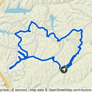
Snowbird Mega Loop
14.1 mi · 1025 ft gain · 73 ft/mi · Loop · Bella Vista

Lake Ann Wide North Loop
15.8 mi · 1300 ft gain · 82 ft/mi · Loop · Bella Vista

Lake Avalon to Modifico Loop
16.4 mi · 1375 ft gain · 84 ft/mi · Loop · Bella Vista

Bear Hollow Mega Loop
16.7 mi · 1250 ft gain · 75 ft/mi · Loop · Bella Vista
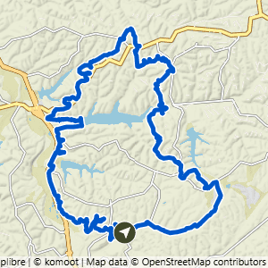
Gear Garden to Mega Loop North
17.8 mi · 1400 ft gain · 79 ft/mi · Loop · Bella Vista