
Hiking Trails in Bentonville
Bentonville is home to 70+ miles of trail and the birthplace of Northwest Arkansas’s purpose-built trail movement. Spread across five distinct trail systems—Coler Preserve, Crystal Bridges & Compton Gardens, Handcut Hollow, Osage Park, and Slaughter Pen + Park Springs—the city offers everything from flat paved greenways and boardwalks to challenging hand-cut single-track. Whether you’re new to hiking or a seasoned trail runner, Bentonville’s trail network has something for everyone.
Trails in Bentonville at a glance
Explore the trail systems
Coler Preserve
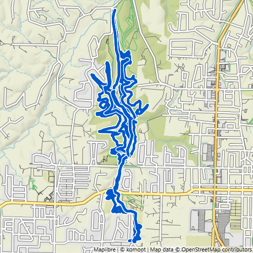
~16 miles (11+ hike-friendly) · Paved Greenway + Natural Surface · Owned & Operated by the Peel Compton Foundation
A purpose-built mountain-bike preserve just west of downtown—the most bike-forward system in Bentonville, but with more for hikers than you’d expect. A paved greenway makes an easy 5-mile out-and-back, while Esther’s, Oscar’s Loop, and Good Vibrations headline about 11 hikeable natural-surface miles. Cap it off with coffee at Airship at The Homestead.
Crystal Bridges & Compton Gardens Trails

~5 miles · Paved + Natural Surface · Owned & Operated by Crystal Bridges Museum of American Art & the Peel Compton Foundation
One of the most beautiful and accessible places to walk in Bentonville—and every trail here is open to hikers. Nearly 5 miles of paths link the grounds of the Crystal Bridges Museum of American Art with historic Compton Gardens & Arboretum, winding through Ozark woods and world-class outdoor art. Favorites include the paved Art Trail, the Orchard Trail, and the wooded Tulip Tree trail.
Handcut Hollow

~16 miles (13+ hike-friendly) · Natural Surface · Owned & Operated by the Trailblazers
A compact, super-fun system tucked into a wooded hollow on the north edge of town, with hand-cut tread that drains well after rain. Nearly everything here is open to hikers, with lots of great loops to link together. Don’t miss Zone 4—a challenging, beautiful climb and the standout hike—while the long Traverse Loop anchors the system for anyone wanting more distance.
Osage Park

Compact — up to a ~4-mile loop · Paved + Boardwalk, Nearly Flat · Owned by the City of Bentonville, Operated by the Peel Compton Foundation
The most accessible walking in Bentonville—a flat oasis of paved paths and floating boardwalks winding through restored Ozark wetlands in the heart of town. There’s virtually no elevation and nothing off-limits to hikers, so it’s ideal for strollers, wheelchairs, and first-time walkers. Weave the paths together and you can stitch a 4-mile “spaghetti loop” without ever leaving the park.
Slaughter Pen + Park Springs

30+ miles (20+ hike-friendly) · Paved Greenway + Natural Surface · Owned & Operated by the Trailblazers & the City of Bentonville
Bentonville’s original trail system, spilling right out of downtown near Crystal Bridges—more than 30 miles of trail with the paved Razorback Greenway running through as an easy, accessible spine. More than 20 of those miles are hike-friendly: Medusa and Tatamagouche linked together make a great moderate hike, while Black Apple Creek and Burns Arboretum are beautiful walks on the Park Springs side.
Start your Bentonville hike here
Popular trailheads


Hiking Bentonville — what to know
Trails for every season
Bentonville trails are hikeable no matter the temperature, and most are even good to hike right after a rain—or even during one. In summer, vegetation can crowd the trail edges and ticks are more of a hazard; in fall, the trails are often covered in inches of leaves—sometimes slippery, but still very hikeable; and in winter, with the leaves down, the trails look completely different.
Why Bentonville trails stand out
Bentonville is where NWA’s purpose-built trail movement began, and its 70+ miles of engineered, multi-use trails are maintained by dedicated local stewards—the Trailblazers, the Peel Compton Foundation, and volunteers. You’ll find everything from smooth paved greenways and boardwalks to technical single-track, with each route designed to serve hikers, runners, and bikers.
Parking & access
Bentonville’s trailheads are generally paved and accommodate anywhere from 10 to 50 or more vehicles. Popular trailheads can fill up by mid-morning, so arrive early and have a backup in mind if a small lot is full.
A note on trail etiquette
Nearly every Bentonville trail is multi-use, shared with hikers, trail runners, and mountain bikers. As a general rule, bikes are supposed to yield to people on foot—but in practice they don’t always, so it’s best that whoever can step aside most easily does, usually the hiker or trail runner.
Ready to explore?
Find your route
Browse every Bentonville hike and filter by distance, difficulty, and trail system to find the one that fits your preferences.
Browse All RoutesFind a trailhead
See every Bentonville trailhead on an interactive map, with parking details and directions so you know exactly where to start.
View Trailhead MapExplore the trail systems
Get to know each of NWA’s trail systems, including what their trails are like and who maintains them.
See All Trail SystemsConnect with the community
Join the Bella Vista Walks & Hikes Facebook group to find hiking partners, hear about trail workdays, or help lead hikes across NWA.
Join the FB Group