How to start hiking in Northwest Arkansas.

Which trails to hike at Slaughter Pen + Park Springs—and which not to
This is every trail in the system, all 91 of them. If you are putting together your own route, stay on the ones in the “Good to Hike” list.
Good to hike
54 trails
Hike any of these
- 2 Stacks
- A to J Gravel Connection
- Action Alley
- All American
- Allencroft East
- Allencroft West
- Angus Chute
- Angus Chute (Gully)
- Angus Chute Connector
- Apple Turnover
- Armadillo's Last Stand
- Berkeley's Holler
- Berm Creek Return
- Black Apple Creek
- Black Limousin
- Burns Arboretum (North)
- Burns Arboretum (South)
- Bush Push
- Downhill Connector
- Expressway
- Free Time
- Heading Home
- Hidden Hollow Connector
- Hidden Hollow Loop
- Hidden Hollow Loop Access
- Highway to Heaven
- J Street Connector
- Jesse's Connection
- Leopard Loop East
- Lombard
- Maple Connector
- Medusa
- Milk Run
- Northeast J Street Connector
- Oak Connector
- Oesta Vista
- Ozone North
- Razorback Ridge
- Red Barn
- Rock Ledge Trail
- Rocking Horse
- Rocking to Zeppelin
- Rocky Ridge (North)
- Rocky Ridge (South)
- Rocky Ridge South Connector
- Rotten to the Core
- Schroen Train (South of Berkeley's Holler)
- Scott Allen Alley
- Seed Tick Shuffle
- Sliding Rock
- Tatamagouche
- Upper Angus Chute
- Urban
- Zeppelin
Don’t hike
37 trails
Don’t hike any of these
- All American from NE 3rd St to Rocking Horse
- All American Skill Line
- Apple Dumplin
- Barn Burner
- Berm Creek
- Bone Yard
- Boo Boo
- Bullet
- Castle Climb
- Catapult
- Choo Choo
- Creekside
- Cry Baby
- Dragon Scales
- Firnas
- Free Time Drop Line
- Free Time Ladder Bridge
- Hammer Down
- Jesse's Last Stand
- Leopard Loop West
- Loam Wolf
- Master Plan (North)
- Master Plan (South)
- Medieval
- Moo Moo
- Rim Trail
- Schroen Train (North)
- Shotgun
- Skid Marks
- Slaughter Pen Expert Skills Park
- Techgnar
- The Masterpiece
- Tristan's Trail
- Uwabami
- Walter's Whistler
- Wildfire
- Yeah Buddy
A trail lands on the don’t hike list for one of three reasons. Some are posted bike-only, and that is almost always because of what the trail is—a gravity or downhill line where the traffic moves one way and moves fast. Others are technically open to foot traffic, but due to the nature of the trail, putting hikers and bikers on the trail together is dangerous, so avoiding them is our recommendation. And a few are perfectly fine to hike but sit off on their own or run only a few hundred feet, so there is no real sense in hiking them.
Heading to another system? You can see every trail we have mapped in one place.
Too many options? Filter these by distance & difficulty →

Cub Circle to Rocking Horse, Heading Home, and Rotten to the Core
1.57 mi · 125 ft gain · 80 ft/mi · Loop · Bentonville

Cub Circle to Rocking Horse, Heading Home, and Apple Turnover
1.65 mi · 150 ft gain · 91 ft/mi · Loop · Bentonville

Hidden Springs to All American
1.81 mi · 50 ft gain · 28 ft/mi · Loop · Bentonville
This route includes about 1.4 miles of paved Greenway.

Park Springs to Black Apple & Burns
2.15 mi · 125 ft gain · 58 ft/mi · Loop · Bentonville

Hidden Springs to Armadillo, Jessie's Climb, Medusa & Tatamagouche
2.2 mi · 175 ft gain · 80 ft/mi · Loop · Bentonville
This route includes about .3 miles of paved Greenway.

Blue Hole to Slaughter Pen
2.61 mi · 100 ft gain · 38 ft/mi · Lollipop · Bentonville
This route has a section with some more challenging up-and-down climbing for part of the return section.

Blue Hole to Slaughter Pen on Greenway
2.65 mi · 100 ft gain · 38 ft/mi · Out & Back · Bentonville

Hidden Springs to Tatamagouche & Medusa
2.86 mi · 225 ft gain · 79 ft/mi · Loop · Bentonville
This route includes about .4 miles of paved Greenway.

Cub Circle to Black Apple, Park Springs, Zeppelin & Greenway
2.95 mi · 175 ft gain · 59 ft/mi · Loop · Bentonville
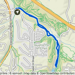
Hidden Springs to All American & Greenway
2.99 mi · 100 ft gain · 33 ft/mi · Loop · Bentonville
This route includes about 1.75 miles of paved Greenway.
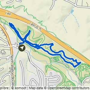
Hidden Springs to Armadillo's Last Stand+
2.99 mi · 200 ft gain · 67 ft/mi · Loop · Bentonville
This route includes about .3 miles of paved Greenway.
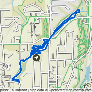
Park Springs to Burns, Black Apple & Rotten to the Core
3.04 mi · 150 ft gain · 49 ft/mi · Lollipop · Bentonville

Park Springs to Burns & Black Apple
3.08 mi · 175 ft gain · 57 ft/mi · Loop · Bentonville

Park Springs to Burns & Full Black Apple
3.27 mi · 150 ft gain · 46 ft/mi · Lollipop · Bentonville

Cub Circle to Full Black Apple & Burns Arboretum
3.37 mi · 125 ft gain · 37 ft/mi · Lollipop · Bentonville

Hidden Springs to Bentonville Braum's
3.39 mi · 200 ft gain · 59 ft/mi · Out & Back · Bentonville

Park Springs to Black Apple, Burns & Heading Home
3.43 mi · 175 ft gain · 51 ft/mi · Lollipop · Bentonville

Cub Circle to Full Black Apple & Burns Artboretum
3.45 mi · 150 ft gain · 43 ft/mi · Loop · Bentonville

Park Springs to Black Apple, Burns, Apple Turnover & Heading Home
3.49 mi · 175 ft gain · 50 ft/mi · Lollipop · Bentonville

Hidden Springs to Angus Chute & Urban Trail
3.53 mi · 175 ft gain · 50 ft/mi · Lollipop · Bentonville
This route includes about .5 miles of paved Greenway.

Hidden Springs to Armadillo, Medussa & Tatamagouche
3.74 mi · 250 ft gain · 67 ft/mi · Loop · Bentonville
This route includes about .3 miles of paved Greenway.

Hidden Springs to Angus Chute & Razorback Ridge
3.85 mi · 225 ft gain · 58 ft/mi · Lollipop · Bentonville
This route includes about .4 miles of paved Greenway.

Hidden Springs to Black Limousin, Angus Chute, Urban Trail & Razorback Ridge
3.95 mi · 250 ft gain · 63 ft/mi · Lollipop · Bentonville
This route includes about .4 miles of paved Greenway.
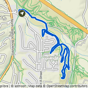
Hidden Springs to Black Limousin & Urban Trail
3.97 mi · 225 ft gain · 57 ft/mi · Lollipop · Bentonville
This route includes about .4 miles of paved Greenway.

Park Springs to Black Apple, Heading Home, Rocking Horse & Burns
4.08 mi · 225 ft gain · 55 ft/mi · Lollipop · Bentonville

Park Springs to Black Apple, Heading Home, Rocking Horse, Turnover & Burns
4.13 mi · 225 ft gain · 54 ft/mi · Lollipop · Bentonville

Park Springs to Burns, Black Apple+ & Heading Home
4.61 mi · 275 ft gain · 60 ft/mi · Lollipop · Bentonville

Cub Circle to Oesta Vista, Hidden Hollow & Rocky Ridge
4.63 mi · 225 ft gain · 49 ft/mi · Lollipop · Bentonville

Blue Hole to Boneyard on Greenway
4.7 mi · 125 ft gain · 27 ft/mi · Out & Back · Bentonville

Hidden Springs to Tatamagouche, Medusa, Seed Tick & Armadillo
5.54 mi · 375 ft gain · 68 ft/mi · Loop · Bentonville
This route includes about .5 miles of paved Greenway.

Blue Hole to Cub Circle on Greenway
5.88 mi · 175 ft gain · 30 ft/mi · Out & Back · Bentonville

Cub Circle to Razorback Ridge+
6.17 mi · 350 ft gain · 57 ft/mi · Lollipop · Bentonville