How to start hiking in Northwest Arkansas.

No trails to avoid at Crystal Bridges & Compton Gardens Trails
Every trail in this system is open to foot traffic and fine to hike, so put together whatever route you like. Some of our other systems have gravity and downhill trails that hikers need to stay off, but there is nothing like that here.
Heading to another system? You can see every trail we have mapped in one place.
Too many options? Filter these by distance & difficulty →
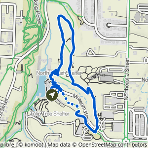
Crystal Bridges to Forest Trail
1.68 mi · 100 ft gain · 60 ft/mi · Loop · Bentonville
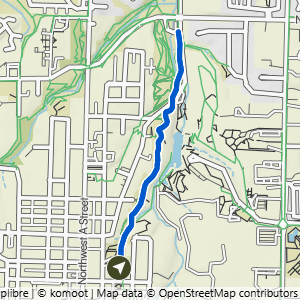
Compton Gardens to Cub Circle
1.96 mi · 200 ft gain · 102 ft/mi · Out & Back · Bentonville

Compton Gardens to Greenway & Crystal Bridges
2.44 mi · 250 ft gain · 102 ft/mi · Lollipop · Bentonville
This route includes several sections of stair steps.

Crystal Bridges to Tulip Tree & Compton
2.62 mi · 150 ft gain · 57 ft/mi · Lollipop · Bentonville
There are a lot of stair and stone steps on this route.

Northeast A St to Crystal Bridges Loop
2.68 mi · 200 ft gain · 75 ft/mi · Loop · Bentonville

Northeast A St to Compton Gardens & Crystal Bridges
2.99 mi · 225 ft gain · 75 ft/mi · Lollipop · Bentonville

Crystal Bridges to Compton, Greenway & Forest Trail
3.9 mi · 250 ft gain · 64 ft/mi · Lollipop · Bentonville
There are a lot of stairs and stone steps on this route.