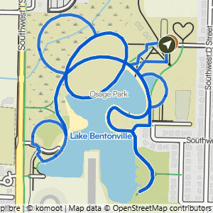
These routes are on smooth, hard-surface paths that are typically 6 feet or more wide, with no rocks or roots to navigate. The slope of the trail can vary, with some being nearly flat and others having noticeable inclines and hills.
Easy
These routes are on natural-surface dirt or gravel trails that are about 3 feet wide or wider. The trail has gentle slopes with an average grade/incline of 5% or less and a generally stable surface.
Moderate
These routes include natural-surface trails that are often about 2 feet wide. The trails can have moderate slopes/inclines, with some sections being quite steep. Obstacles may include rocks and roots up to about 8 inches high, so hikers should have good stability.
Challenging
These routes include natural-surface trails that are often only 1 foot wide (or narrower) and have steep slopes with significant climbs and descents (15% grade or more). Frequent obstacles may include rocks and roots 15 inches high or taller. Hikers must have excellent stability.
Every trail in this system is open to foot traffic and fine to hike, so put
together whatever route you like. Some of our other systems have gravity and
downhill trails that hikers need to stay off, but there is nothing like that here.