• Skip to main content

Hike NWA

How to start hiking in Northwest Arkansas.

  • Home
  • Explore
    • Cities
      • Bella Vista
      • Bentonville
    • Trail Systems
    • Trailheads
    • Trail Difficulty
    • Trail Surfaces
  • Plan a Hike
    • Getting Started
    • Which Trails are Hikeable?
    • Route Library
    • Beginners’ Hiking Guides
    • How to Navigate on the Trail
    • FAQs
  • About
    • Our Team
    • Contact
  • Get Involved
    • Lead a Hike
    • Donate

Main Content

Hike more. Live more.

How to start hiking in Northwest Arkansas.

New to the area? Hike NWA is a free guide to the trails of Bella Vista and Bentonville—where to park, what to expect, and which route fits you—built for people who have never set foot on a trail here.

Find a Hiking Route Go to the Beginner’s Guide

How it works

Your first hike, in three steps.

You don’t need special gear, experience, or a group. Here’s the short path to your first hike on the trails of Northwest Arkansas.
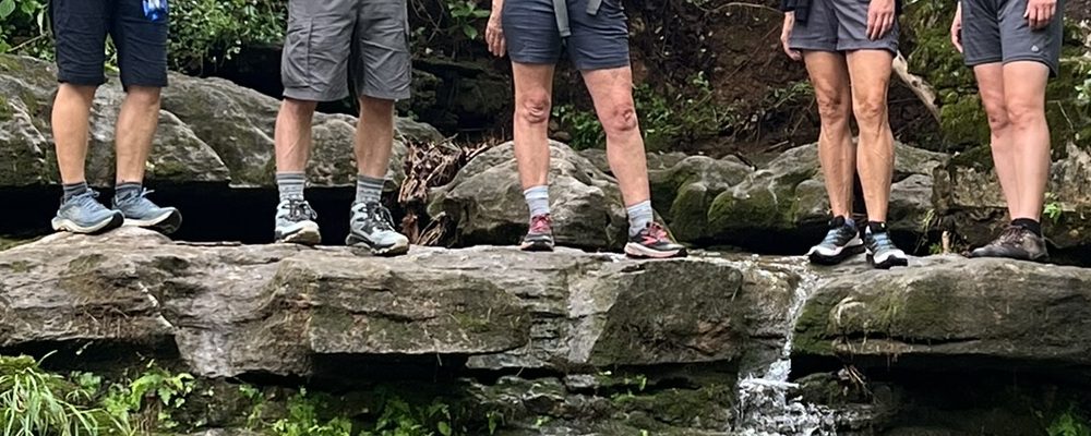
Hikers on a Northwest Arkansas trail 1

Learn the basics

What to expect, what to bring, and some basic trail etiquette so your first hike feels easy, not intimidating.

Getting Started
Bear Hollow 2

Know where to park

Trailhead parking ranges from small gravel pull-offs to full paved lots. We’ll show you exactly where to park.

Where to Park
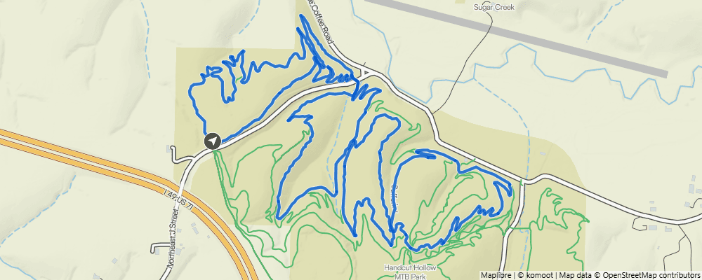
Trail route map 3

Pick your route

Filter every hiking route by distance and difficulty to find one that fits your preferences perfectly.

Find a Route

Park here. Start here.

44 good places to start a hike.

These are the trailheads we map—not every place you can park, but the ones that make the best starting points for hikers. Click a pin to view the information about the parking lot, directions, and any available restrooms. Then open that trailhead’s page to see every hiking route that starts from that location.

Back 40 · Blowing Springs · Coler Preserve · Crystal Bridges & Compton Gardens Trails · Handcut Hollow · Little Sugar · Osage Park · Slaughter Pen + Park Springs · Wonderland
See all 44 trailheads

Allen’s Food Market · Artist Retreat Center (ARC) Trailhead · Bear Hollow Trailhead · Bella Vista AoG · Bella Vista Community Church · Bella Vista Museum · Bella Vista Police Department · Blowing Springs Trailhead · Blue Hole Parking Area · Bluebird Trailhead · Branchwood · Buckingham Trailhead · Chelsea & Arthur Trailhead · Coler South · Compton Gardens Trailhead · Crystal Bridges Museum · Cub Circle · Down Under Water Tower Trailhead · Gear Garden · Handcut Hollow @ Grammercy Trailhead · Handcut Hollow @ J St. Trailhead · Handcut Hollow @ the Schoolhouse Trailhead · Hidden Springs · Kingsdale Trailhead · Kingswood Trailhead · Lake Ann Trailhead · Lake Avalon Trailhead · London Drive Water Tower Trailhead · Mace Lane · Metfield Skills Park · Northeast A St Park · Osage Park · Park Springs Trailhead · Pinion Creek Falls Trailhead · Play Thru Trailhead · Pontoon Park Trailhead · Power Station · Scotsdale Trailhead · Snowbird Trailhead · Tanyard Creek · Tower Trailhead · Tweety Bird Trailhead · Veterans Wall of Honor · Wonderland Trailhead

Two cities, and counting

Hiking trails across Northwest Arkansas, one area at a time.

Hike NWA got its start in Bella Vista, so we’re beginning in our hometown and working outward across Northwest Arkansas. Each city page groups its trails by system, so you can see what’s close to you before you drive anywhere.

Tanyard Creek in Bella Vista

Bella Vista

More than 120 miles of multi-use trails surrounded by beautiful trees and limestone bluffs.

Bella Vista trails
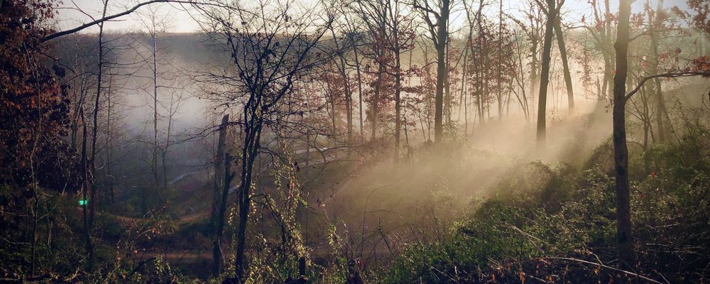
Bentonville trails

Bentonville

More than 75 miles of trail across six systems, from flat paved greenways to hand-cut single-track.

Bentonville trails
The Back 40 trail system

Trail systems 101

Not sure what “Slaughter Pen” or “Back 40” are? Start here. We explain the trail systems in NWA.

How trail systems work

Coming soon: Rogers · Springdale · Fayetteville · Eureka Springs · Hobbs State Park · Devil's Den · Siloam Springs

Route finder

Find a hiking route that fits your day.

New to the area? Start with a Beginner’s Guide, a curated list you can work through in order. Or search the whole library — a paved one-mile walk and a hard six-mile climb are both a click away.

Each route shows how far it goes, how hard it is, and how much you climb per mile, plus anything you should know before you go. Here’s what each difficulty level means. Every filter is optional—leave them blank to include everything.

Start your search

Filter by distance
to miles
Filter by difficulty What do the levels mean?

What do the difficulty levels mean?

Paved

These routes are on smooth, hard-surface paths that are typically 6 feet or more wide, with no rocks or roots to navigate. The slope of the trail can vary, with some being nearly flat and others having noticeable inclines and hills.

Easy

These routes are on natural-surface dirt or gravel trails that are about 3 feet wide or wider. The trail has gentle slopes with an average grade/incline of 5% or less and a generally stable surface.

Moderate

These routes include natural-surface trails that are often about 2 feet wide. The trails can have moderate slopes/inclines, with some sections being quite steep. Obstacles may include rocks and roots up to about 8 inches high, so hikers should have good stability.

Challenging

These routes include natural-surface trails that are often only 1 foot wide (or narrower) and have steep slopes with significant climbs and descents (15% grade or more). Frequent obstacles may include rocks and roots 15 inches high or taller. Hikers must have excellent stability.

Not sure what these surfaces look like? See the photos →

Hikers making their way up a wooded trail in Bella Vista

One short hike at a time

The beginner’s guide to hiking Northwest Arkansas

52 short hikes—all under three miles—take you from your first easy walk on pavement all the way to our most challenging trails, introducing you to nearly every trailhead we map along the way. Start where you’re comfortable, check off hikes as you finish them, and move up when it feels easy.

  • Paved12 hikes
  • Easy6 hikes
  • Moderate26 hikes in three stages
  • Challenging8 hikes

Go at your own pace—one hike a week finishes the guide in a year, two a week in six months, three a week in about four months.

View the Guide

Hike with others

You don’t have to hike alone.

Some of the best hikes happen when you hike with others. Northwest Arkansas has a warm, welcoming community of hikers, from nervous first-timers to folks who know every trail, and they’d love to have you along. Come find them, or take it a step further and lead a hike yourself—we will teach you everything you need to know.

A Hike NWA community group hike

Community hikes

Hike NWA brings people together regularly for organized community hikes in Bella Vista, open to every pace and experience level. Show up, say hi, and hit the trail together.

Find a Community Hike

Bella Vista Walks & Hikes

Bella Vista Walks & Hikes

Our friendly private Facebook group is the easiest place to start hiking regularly with a group. Hike leaders post recurring organized group hikes—no experience required.

Ask to join our private Facebook group
A group of hikers walking a wooded Northwest Arkansas trail together

Lead a Hike

We’ll teach you to lead, help you get familiar with the routes, and promote the hike so others can join you on the trail. Leading not only helps others get out and hike, it helps you keep hiking regularly.

How to lead a hike

Support Hike NWA

Help more people get on the trail.

Hike NWA is a volunteer-run 501(c)(3) nonprofit. Your donation supports our whole mission, not just this website.

  • Hiker education—guides, routes, trail information, and Hiking 101 workshops.
  • Community events—group hikes and events that help people get onto the trail.
  • Trail stewardship—caring for the local trails all of us use.
Donate to Hike NWA

Explore & Plan a Hike

  • Bella Vista
  • Bentonville
  • Trail Systems
  • Trailheads & Parking
  • Route Library
  • FAQs
  • Hike Event Generator

Guides & Resources

  • Getting Started on the Trails
  • Which Trails are Hikeable?
  • Beginner’s Hiking Guide
  • Trail Difficulty
  • Trail Surfaces
  • How to Use a Navigation App
  • Bella Vista Walks & Hikes

Hike NWA

  • History & Mission
  • Donate
  • Contact Us
  • Privacy Policy
  • Terms of Use
  • Donation Policy
  • Accessibility
  • Hike Lead Dashboard
  • Facebook
  • Instagram
  • Strava
  • Komoot

Copyright © 2026 · Hike NWA · A registered 501(c)(3) nonprofit organization
412 Town Center NE #1044, Bella Vista, AR 72714 · EIN: 42-2911997

Powered by
►
Necessary cookies enable essential site features like secure log-ins and consent preference adjustments. They do not store personal data.
None
►
Functional cookies support features like content sharing on social media, collecting feedback, and enabling third-party tools.
None
►
Analytical cookies track visitor interactions, providing insights on metrics like visitor count, bounce rate, and traffic sources.
None
►
Advertisement cookies deliver personalized ads based on your previous visits and analyze the effectiveness of ad campaigns.
None
►
Unclassified cookies are cookies that we are in the process of classifying, together with the providers of individual cookies.
None
Powered by